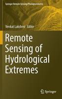
Remote Sensing of Hydrological Extremes
 -15%
portes grátis
Remote Sensing of Hydrological Extremes
Lakshmi, Venkat
Springer International Publishing AG
12/2016
251
Dura
Inglês
9783319437439
15 a 20 dias
5266
Descrição não disponível.
Part 1 Floods.- Chapter 1 Satellite-based estimation Of water discharge and runoff In the Magdalena River, Northern Andes Of Colombia.- Chapter 2 Remote sensing of drivers of spring snowmelt flooding in the North Central US.- Chapter 3 The NASA Global Flood Mapping System.- Chapter 4 Congo flood plain hydraulics with PALSAR InSAR and Envisat Altimetry data.- Chapter 5 Optical and physical methods for mapping flooding with satellite imagery.- Chapter 6 Near real time flood monitoring and impact assessment systems.- Part 2 Droughts.- Chapter 7 Remote sensing of drought: Vegetation, soil moisture and data assimilation.- Chapter 8 Drought monitoring and assessment using remote sensing.- Chapter 9 A framework for assessing soil moisture deficit, and crop water stress at multiple space and time scales under climate change scenarios using model platform, satellite remote sensing and decision support system.- Chapter 10 Monitoring drought in Brazil using remote sensing.- Chapter 11 Multi-sensor remote sensing of drought from space.
Este título pertence ao(s) assunto(s) indicados(s). Para ver outros títulos clique no assunto desejado.
Emergency Management;Remote sensing of droughts;Remote sensing of floods;Global Precipitation Measurement;Soil Moisture Active Passive;MODIS;Gravity Recovery and Climate Experiment;remote sensing/photogrammetry;Climate change management
Part 1 Floods.- Chapter 1 Satellite-based estimation Of water discharge and runoff In the Magdalena River, Northern Andes Of Colombia.- Chapter 2 Remote sensing of drivers of spring snowmelt flooding in the North Central US.- Chapter 3 The NASA Global Flood Mapping System.- Chapter 4 Congo flood plain hydraulics with PALSAR InSAR and Envisat Altimetry data.- Chapter 5 Optical and physical methods for mapping flooding with satellite imagery.- Chapter 6 Near real time flood monitoring and impact assessment systems.- Part 2 Droughts.- Chapter 7 Remote sensing of drought: Vegetation, soil moisture and data assimilation.- Chapter 8 Drought monitoring and assessment using remote sensing.- Chapter 9 A framework for assessing soil moisture deficit, and crop water stress at multiple space and time scales under climate change scenarios using model platform, satellite remote sensing and decision support system.- Chapter 10 Monitoring drought in Brazil using remote sensing.- Chapter 11 Multi-sensor remote sensing of drought from space.
Este título pertence ao(s) assunto(s) indicados(s). Para ver outros títulos clique no assunto desejado.


